Present Status
Looking for a river lost beneath the asphalt
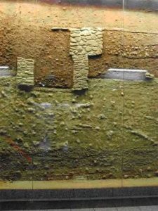
Nowadays, the river (in effect only a stream in terms of volume) still flows underground, except in the excavated area of the Kerameikosarchaeological site, where a relatively large section is open and visible. The construction of the Athens Metro gave light to many traces of the Eridanos. In Syntagma metro station its riverbed is exposed and on display.

Hydria Virtual Museum
The main riverbed of the Eridanos ran transversal to today’s Amalias Avenue. The force of the flowing water becomes evident by the fact that various branches of the riverbed are found near the main watercourse. From there, the Eridanos would flow in the direction of today’s Mitropoleos Street, but nowadays no traces of the river appear there, apart from some old plane-trees in Mitropoleos square whose existence can only be explained by the flow of underground water (such trees usually grow only on the banks of rivers).

Hydria Virtual Museum
In Monastiraki metro station the vaulted brick chambers that were constructed during Roman times in order to cover the wastewater channel can be seen, while in the square above the station, the river is visible through an opening in the ground.
Traces of the river can also be seen in the area of the Agora. The riverflowed in the direction of today’s Adrianou Street and already in the second half of the 6thcentury BC, parts of the river were set underground through two canals. The river was also connected to the Great Drain (which crossed the Athenian Agora), receiving from it all the waste water and the overflow of the torrents.
The final section of the Eridanos that is visible today is found at the Kerameikos site. It is striking to observe the river with its ecosystem still alive, albeit struggling in the midst of the dense city landscape. The surface of the archaeological site remains at the level of the classical period (3m below today’s ground level). The river can be seen crossing the Themistoklean wall at the Sacred Gate. From there it flows southwards, meets up with the Ilissos River, and eventually runs into the gulf of Faliro.

Hydria Virtual Museum
Contemporary Educational programs
After the 1992 severe draught in Greece, many organisations started to conduct awareness and sensitisation campaigns on water consumption and management. The Hellenic Ministry of Culture has since been conducting integrated educational programs on the ancient Eridanos River for both students and the general public, covering natural, cultural and historical aspects of the river, in light of present day pressures (urbanisation, pollution, climate change, etc.).
Educational Program: Eridanos: the river of ancient Athens (2008-2009)
The educational program addresses students of primary and secondary education and takes place at the archaeological site and museum of Kerameikos. The program focuses on water as an important factor in urban development, and on the bond that ancient Athenians had developed to the Eridanos River, as reflected in ancient Greek mythology and religion. The students have the opportunity to tour the archaeological site of Kerameikos, Pompeiion, Dipylon and the Eridanos riverbank. At the end of the educational program students can participate in knowledge games.
Read more in Greek at the Hellenic Culture portal


